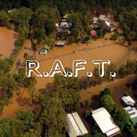
Brunswick Valley Flood History...
FACTS
relating to Flooding
The
following facts describe ongoing poor decision making that has
resulted in an increase of flood levels in the Brunswick Valley.
AIM : To identify relevant facts relating to the June 2005 flood crisis experienced in the Brunswick Valley.
OBJECTIVES : to assist interested persons to understand the true history of flood mismanagement within the Marshall's Creek and Brunswick River systems.
FACT
NO 1.
Major
natural outlet at Wooyung.
Reference Material
1. Wooyung 1887
survey map showing ocean outlet
2.
Wooyung cane drainage map
showing ocean outlet
3. Wooyung
1962 photo showing ocean outlet and roadway
4.
Wooyung 1978
photo showing outlet closed to cater for road
5. Wooyung
map documenting a tidal limit for ocean outlet
FACT
NO 2.
Major natural outlet at Helen Street.
Reference Material
1.
Helen Street
1954 aerial photo showing natural outlets
2.
Helen Street 1958 construction
photo show bulldozed area
3. Photo
of 'NEW' Helen Street blowout 1978
4. Photo of NB & GB 1997
5. DVD of Helen St in the flood - June 30, 2005
FACT
No 3.
Outlets closed mechanically.
Reference Material
see closed outlets -
1. Natural
outlet north of Golden Beach 1944
2. Natural outlet
north of Golden Beach 1947
3. Rainfall
Charts 1944 - 1947
4. Bulldozer
1976 closing outlet north of Fern Beach
5. 1979
B/W Wooyung outlet closed
6. Ministerial
warnings to Council 1982
7. New
Brighton , Golden Beach NOS 1980's closed outlets
8. see timeline on home page
FACT
NO 4.
Major outlet
at Readings Bay Brunswick Heads blocked by
Public Works Department.
Reference Material
1. aerial
photo of Readings Bay with rock walls
2. DVD
Charlie ODonnell
3. newspaper
story 1974 about flood level at New Brighton
4. Professor
Warner report on Readings Bay
5. PWD
report on the Brunswick Heads Breakwall
FACT
NO 5.
Byron Shire Council constructed
levee bank 1m higher than recommended despite warning from engineer
that
this would increase flood
levels outside levee.
Reference Material
1. construction
of levee banks South Golden Beach
2. Consulting
engineers report 1988
FACT
NO 6.
Byron Shire Council engineer admits outlets, dredging and removal
of Readings Bay rock walls "significantly" lowers
flood levels.
Reference Material
1. Councils
letter 1991 outlining significant difference
FACT
NO 7.
Byron Shire Council endorses
flood plain management plan knowing conclusions are false.
Reference Material
1. Marshall
Creek Flood Plain Committee Amended Plan
FACT
NO 8.
Byron Shire Council allows canal to be blocked by bund instead
of bridge as required.
Reference Material
1. Council's letter re construction
of bridge at NOS by Developers
FACT
NO 9.
Cost to date exceeds $1.25m for flood mitigation with flood
levels knowingly increased on existing residential properties.
Reference Material
1. Don
Page MP letter seeking public inquiry 2001
2. Newspaper article September
2001 re call for spending inquiry
More facts to come...
click
on icon above
Latest Flood Information
as at April, 2017
RESOURCE MATERIAL
Therefore we accepts no responsibility for any loss or damages which may occur to any persons as a result of information obtained from this site.